By Jack Huygens, 09 December 2024
Thanks to an amazing anonymous donation, two groups of trampers in the VUWTC were able to do scholarship-funded tramping trips in the summer of 2024!
We were one of those groups, composed of three keen men: Tommy (the tramping machine who needs no introduction), Alan (who was on their first-ever trip to the south island, and our photographer) and Jack (me, the author of this trip report). Our group also previously included Chris, before he mucked up his ankle mere weeks before the trip.
Our goal took shape many months before summer began, with sights on the Tasman Wilderness Area in Kahurangi National Park.
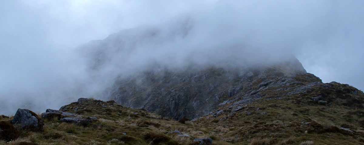
We wanted to do something special, to test our bushcraft and navigation skills on something above and beyond a typical tramping trip, so we couldn't resist the lure of a true "Wilderness Area". For context, a wilderness area is an official designation that means no tracks, bridges, huts or any infrastructure of any kind. Plus a ban on all helicopter usage (aside from emergencies). We would be absolutely reliant on compass navigation, paper topo maps and our own tents. We would be crossing rivers countless times, bashing through scrub, using ropes to lower our packs down a sketchy ridgeline, taking a few snow-grass tumbles, and singing classic tramping songs in a dizzy haze along the way.
Day 1: Entering the Cobb
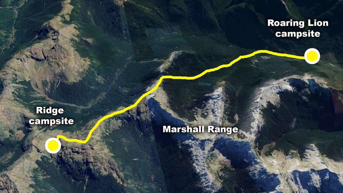
To follow along with our route and location references, you can use the NZTopo50 maps strarting from the end of the Cobb road:
https://www.topomap.co.nz/NZTopoMap?v=2&ll=-41.129377,172.61693&z=14
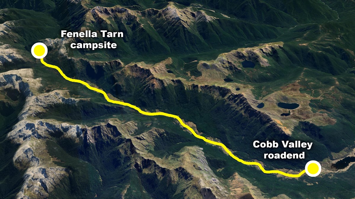
With Chris out of the running and staying home in Wellington, Tommy and Alan took the ferry over the South Island. We all met up in Nelson and stocked up on 7-10 days worth of food (including a staggering 18 RealMeals which will become relevant later). On our drive into the Cobb valley we run into several hippies who all seem to be congregating in the valley, but they are all quite secretive about it… we find out why as shortly after starting the walk up the valley we see a some colorful rainbow stones and jars of white powder which form a trail off the main track. We can hear some sort of yelping in the distance. We decide we probably shouldn’t crash whatever ritual is going on at the end of the trail and continue on into the dark to our campsite for the night at FenellaTarn.
Day 2: Saying goodbye to the DOC track
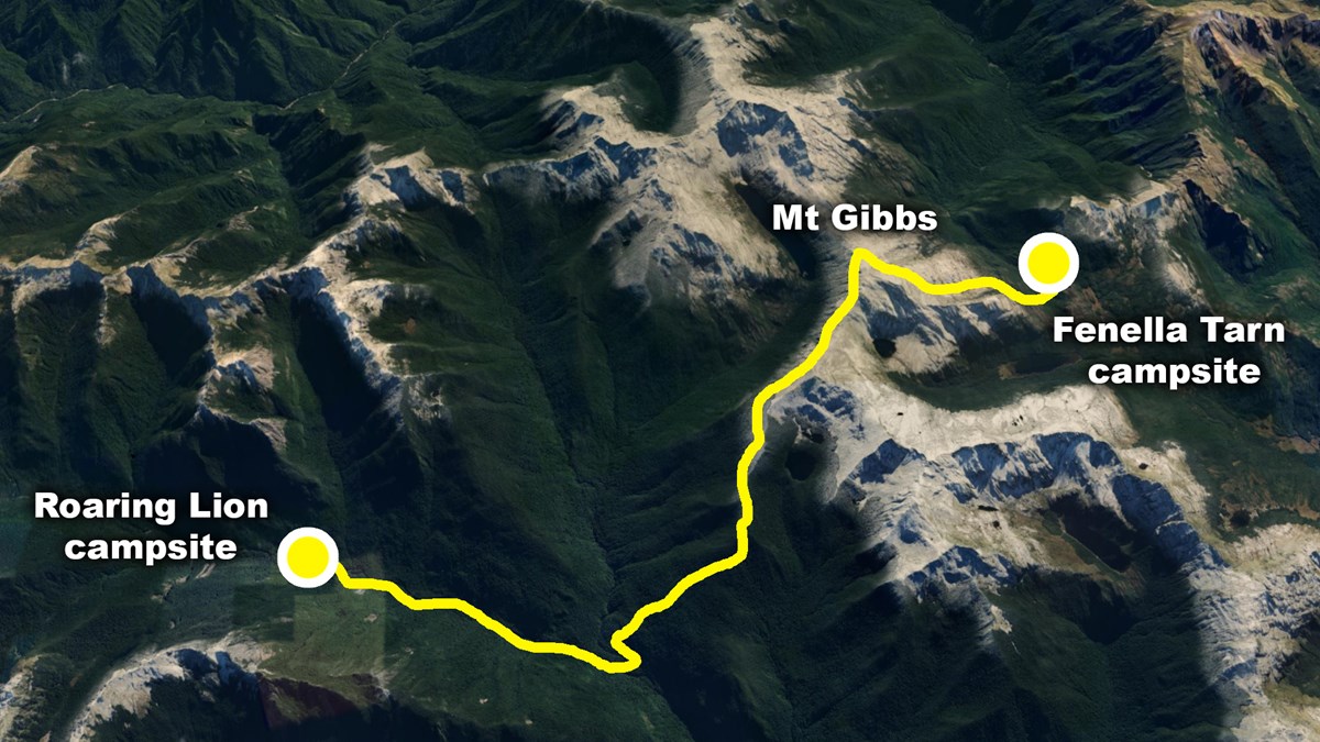
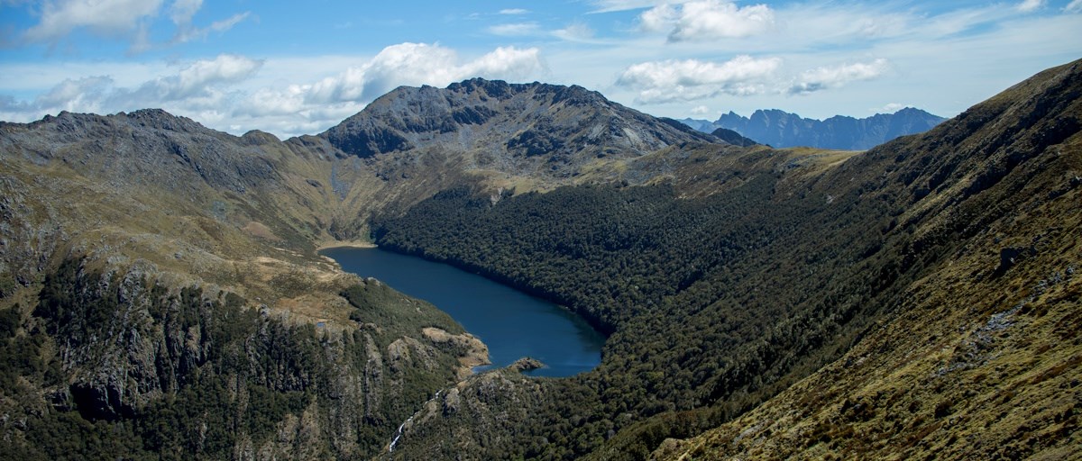
Tommy starts the day off with a swim in the famous Fenella Tarn (which is shockingly warm) and we set off for the start of the real journey. We opt for a more interesting route under Xenicus Peak and up towards Mt Gibbs, and with cracker sunny views we get a full 360 view with our goal in the south (Centre Mountain) along with the jagged Dragon's Teeth ridgeline in the north. We continue on to Pt.1574 with a stunning view of Island Lake and reach our turn-off to enter the official wilderness area.
We enact a quick rendition of the Lord Of The Rings “If i take one more step, i’ll be as far away from the Shire as I’ve ever been!” scene, and head down to Pt.1352 towards the Roaring Lion river.
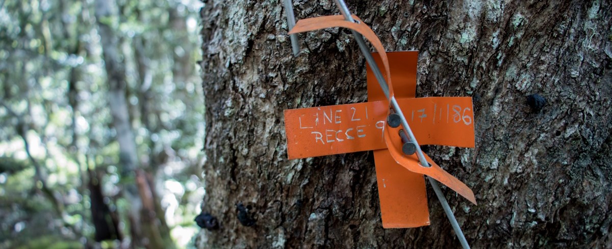
On our way down we managed to find some old markers from 1986 which we confirmed were the EXACT same markers placed by my dad during his days in the NZ Forest Service. It felt very special to be walking in the same footsteps 38 years later, continuing the love of the outdoors that runs in the family.
The bush around here is easy going, in fact it hardly feels like "off track" at all!
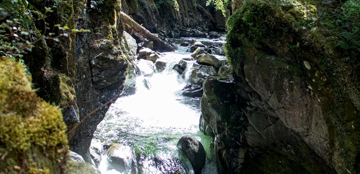
While heading down the hill I go for a small unexpected tumble over a bluff, but luckily stop on a tree trunk before going properly over the edge. Safe to say my adrenaline goes up a bit. Our trip up the Roaring Lion was much more chill, with a back-and-forth of Tommy bounding across the rocks with joy while Alan & I instead opt-ing for the bush, with a bit less confidence with boulder-hopping. We passed an incredible gorge which really made the “Roaring Lion” live up to its name, and eventually reached a beautiful campsite on a calm river flat.
Day 3: Up and over to Lake Aorere
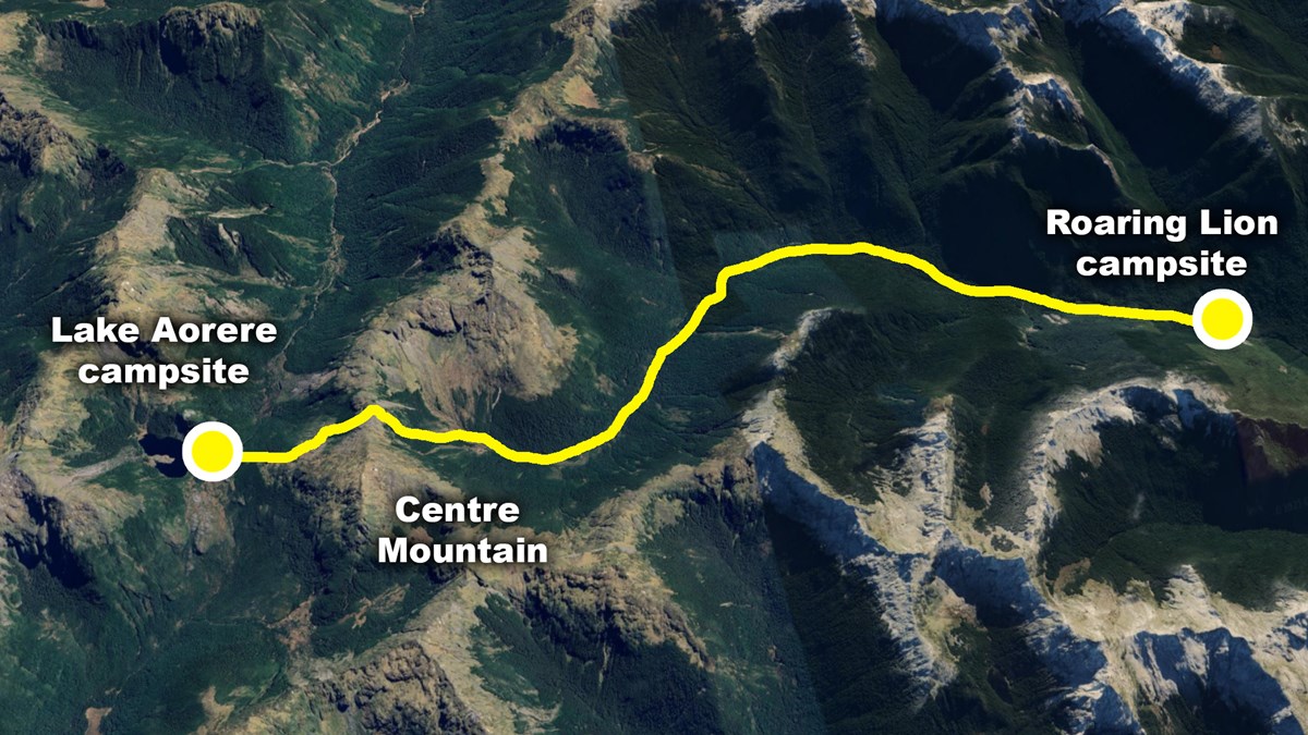
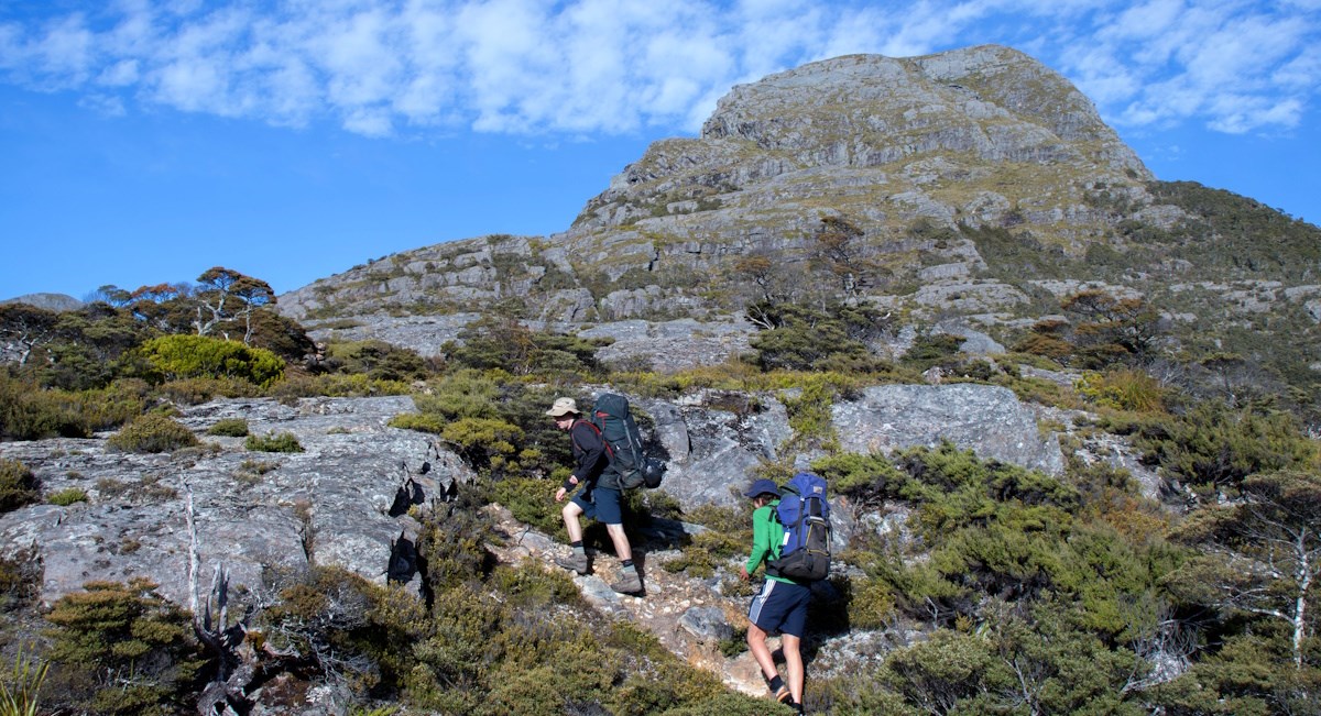
This was probably my favorite day of the whole trip, as we continued up the Roaring Lion all the way into its headwaters. Then up and over a steep saddle all the way to the stunning Lake Aorere, the deepest we would go into the wilderness area.
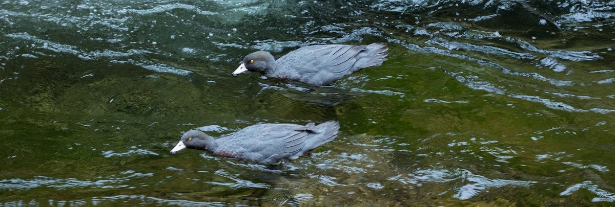
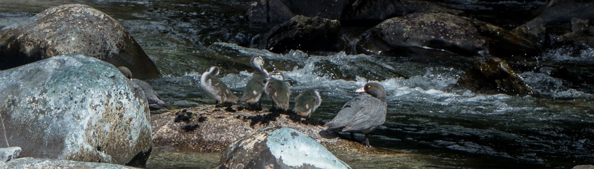
While bashing up the river we run into several families of Whio (very rare native Blue Duck) which were an absolute privilege to see.
We also stumble upon a DOC survey camera, which is probably motion-sensor controlled, so we take the piss out of it for a while and make a few jokes in front of the camera about just how “remote” this wilderness area is, with no technology for miles…
Tommy climbs around on boulders the size of houses in the headwaters of the Roaring Lion.
We make our choice of which saddle to attempt to cross, and begin a VERY steep scrub bash up and over into the Spey River catchment. Despite how nasty the saddle looked from below, we were greeted with very chill terrain once we got to the top, and some beautiful mossy forest on the other side. Despite one block of nasty scrub along the way, our route towards Lake Aorere from the saddle was pretty pleasant. We pat ourselves on the back for some excellent compass navigation, and once at the lake itself we revel in just how deep we currently are into the middle of nowhere. We are a minimum of 3 days hard tramping away from any kind of road access!
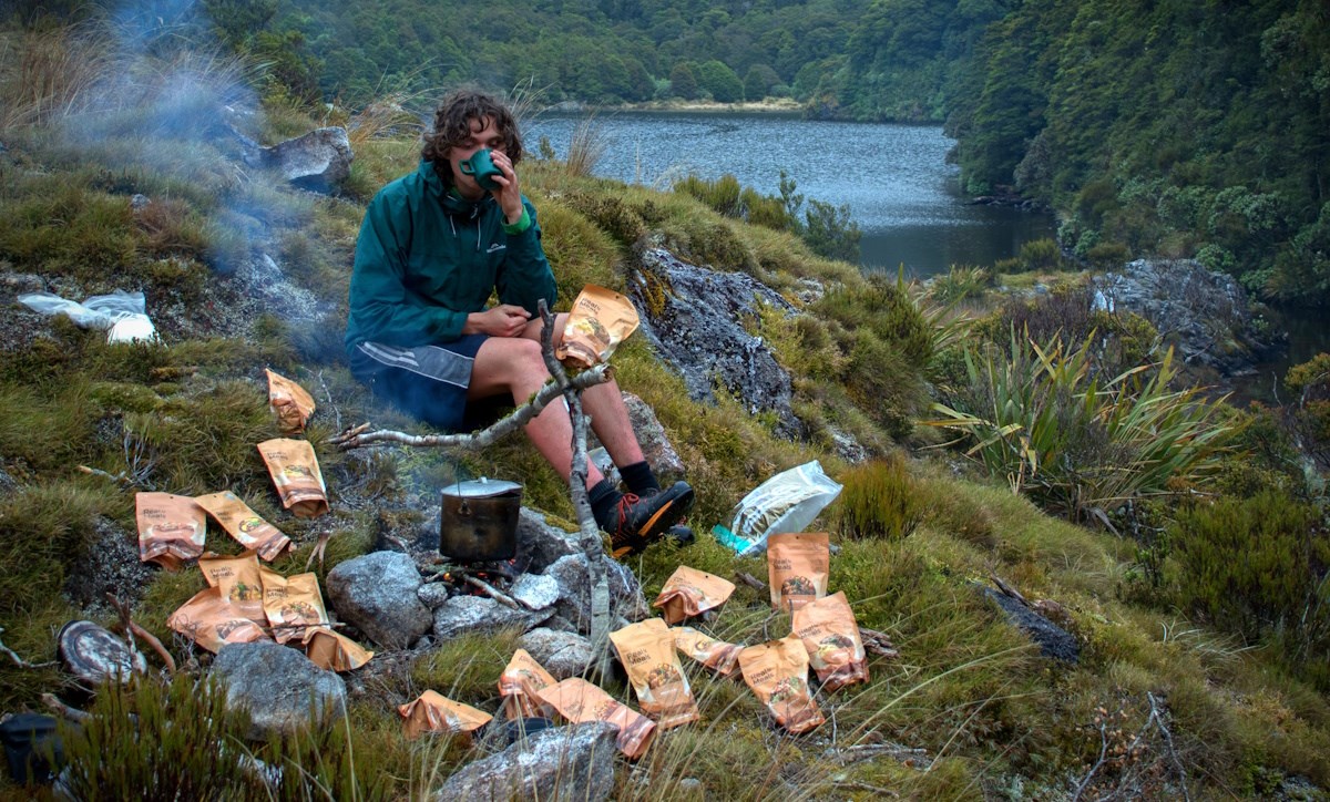
It is at this stage that we do our photo-shoot of Tommy sitting amongst 18 bags of dehydrated RealMeals (which we’ve since entered in a competition):
Day 4: Centre of the wilderness
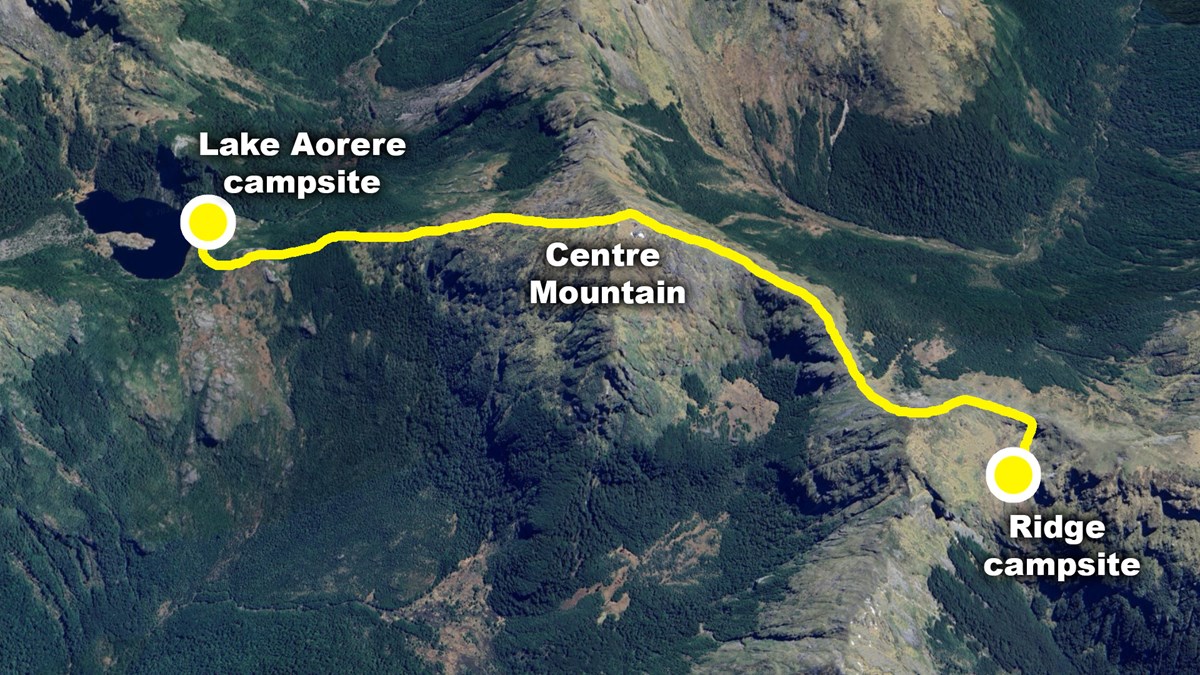
At this stage the clag (and a bit of rain) is pretty well set-in. We spend a “half rest day” chilling in our tents during the drizzle before we head off to the namesake of the trip (Centre Mountain) around mid-day. We begin with a band of gnarly scrub around Aorere Saddle, and begin the steep climb up the mountain. The going is actually pretty good, aside from another small band of scrub that brings me close to breaking point (a brief moment of hopelessness wedged into a near-vertical scrub wall, unable to find a way back or forward) but we make it to the high-point eventually. Unfortunately we have no view, but the gravity of the moment of being on the peak I had been dreaming of for several months of planning, was immense.
We break into song: “I can see clearly now the rain has gone” (we can’t see anything at all).
Spirits are high as we trudge down the incredibly chill western spur of Centre Mountain, seeing a couple of Kea along the way. We continued on to a saddle between Pt.1483 and Pt.1497 and set up our camp in a lovely basin with a small tarn and stunning views down the “Beautiful River” (real name).

Day 5: Choices, choices…
Waking up the next day to a stunningly clear morning, we have some decisions to make. Our original plan involves going down the Beautiful River, but Alan is struggling with the long 11+hr days off-track, Tommy “hasn’t even done any exercise yet”, and I’m stuck somewhere in the middle. We spent a lot of the ridgeline yesterday debating on our options, and the merits of sticking to the plan vs going for the safest option, but we had to make a choice today as to which river catchment we descend into for the next few days.
What would you choose in my position? Personally I leaned on the side of safety, and chose the shorter route home (returning back via the Roaring Lion again) instead of the longer Beautiful River route, much to Tommy’s dismay.
Hopefully the exciting section of ridgeline we did next made up for it a bit!
Almost immediately upon leaving our lovely basin campsite, Tommy goes for a bit of a slide on some snowgrass (if you’ve ever slipped on snowgrass, you know exactly what this looked like). I hear a yelp and see his pack go rocketing down back into the basin, with Tommy looking dazed and confused further up the hill. While heading over to meet him I go for my own slide on the snowgrass, but luckily not quite as dramatic. Damn that stuff is deadly!
Luckily we’re all ok and we learnt our lesson before we got near any big drop-offs.
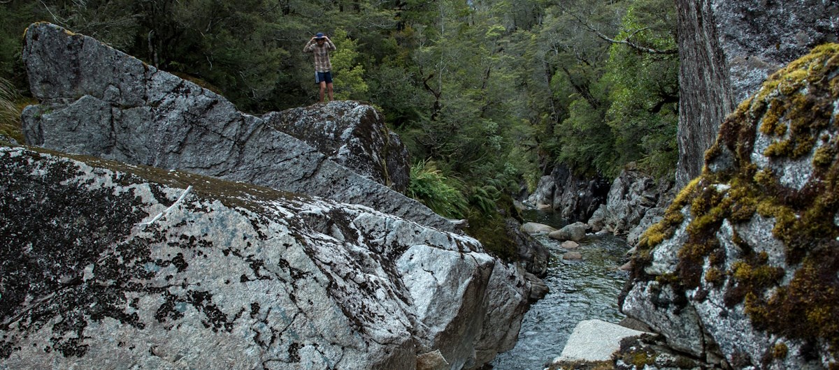
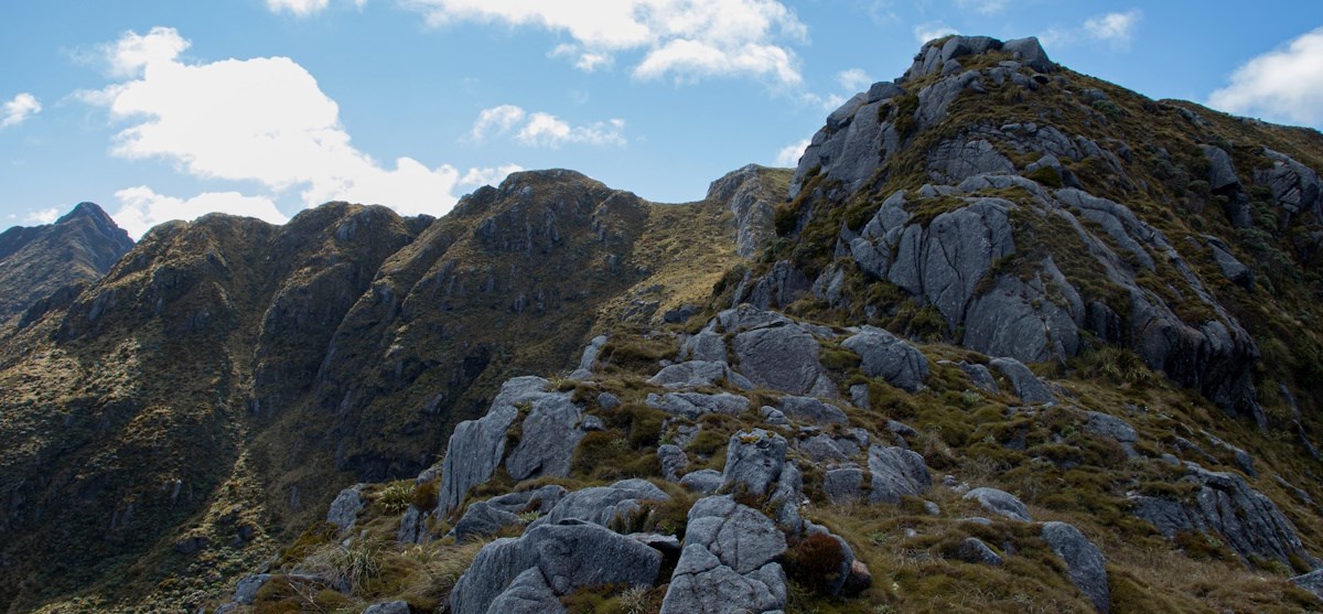
We continued along the stunning ridgeline and briefly stopped and searched for a strange noise, which turned out to be a massive Weka at about 1400m (I didn’t even know they lived up that high). Further along this ridgeline we reach a hell of a drop-off blocking our way (just north of Pt.1497). Luckily Tommy is skilled with ropes and fashions up a system for lowering our packs down to make the climb easier.
As someone who is quite inexperienced with climbing, this moment scared the ever-loving-shit out of me. Alan and Tommy loved it though!
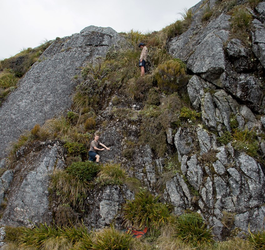
The photo doesn’t do justice to how big of a vertical drop this was, I swear!
Luckily that was the only sketchy section of the ridge we had to deal with, and the rest was pretty cruisy. Further on we make a very arduous scrub bash sidle around Pt.1524, because I forgot the age-old rule of off-track travel: sidles are always awful. But on the plus side we randomly got cell reception in the middle and got a full weather update!
The rest of our day consisted of a beautiful bash through stunning forest down an unnamed creek to connect back in with the Roaring Lion. During this section our singing reached its peak, with lots of hits from the beloved “Bush Singalong” album, and endless loops of “Taumarunui, Taumarunui, Taumarunui on the main trunk line” as we descended further into madness (the good kind of madness, the kind you get from a whole week in the bush).
We reached our familiar grounds of the Roaring Lion, and camped in a large clearing which was cut back in the forest service days, and clearly still being used by DOC staff every now and then (again, so much for a “wilderness area”).
Day 6: Back down the Roaring Lion
Waking up to a stunning dawn chorus of birdsong, I’m sitting on the shore of the Roaring Lion thinking about how special it is to be in a place like this, where so few people ever visit, looking out into this misty bush that probably looks identical to what my dad saw while doing biodiversity survey work here back in the 1980’s. We truly are so lucky in New Zealand to have such stunning wilderness freely available, to anyone who’s willing to push far enough to get there.
Our day consists of bashing back down the Roaring Lion, aiming for different banks of the river for variety, and again running into more Whio (this time a full family, with 4 ducklings!). With sunny weather and being homeward bound, the experience is very chill.
Our return climb up the hill out of the Roaring Lion I dubbed “The Slog”, as it consisted of 1000m of constant uphill identical beech forest, which burnt through the last of me and Alan’s energy. From here on out we’re thoroughly in the “post-exhaustion insanity vibes” stage, while Tommy and I rant about topics like freedom-of-speech, vaccine passes, making plans to go explore Garibaldi and the Domett Range, shitting on David Seymor, etc.
Alan legs it ahead of us, likely with a boost of energy upon reaching the edge of the wilderness area, and also likely sick of me and Tommy’s yapping.
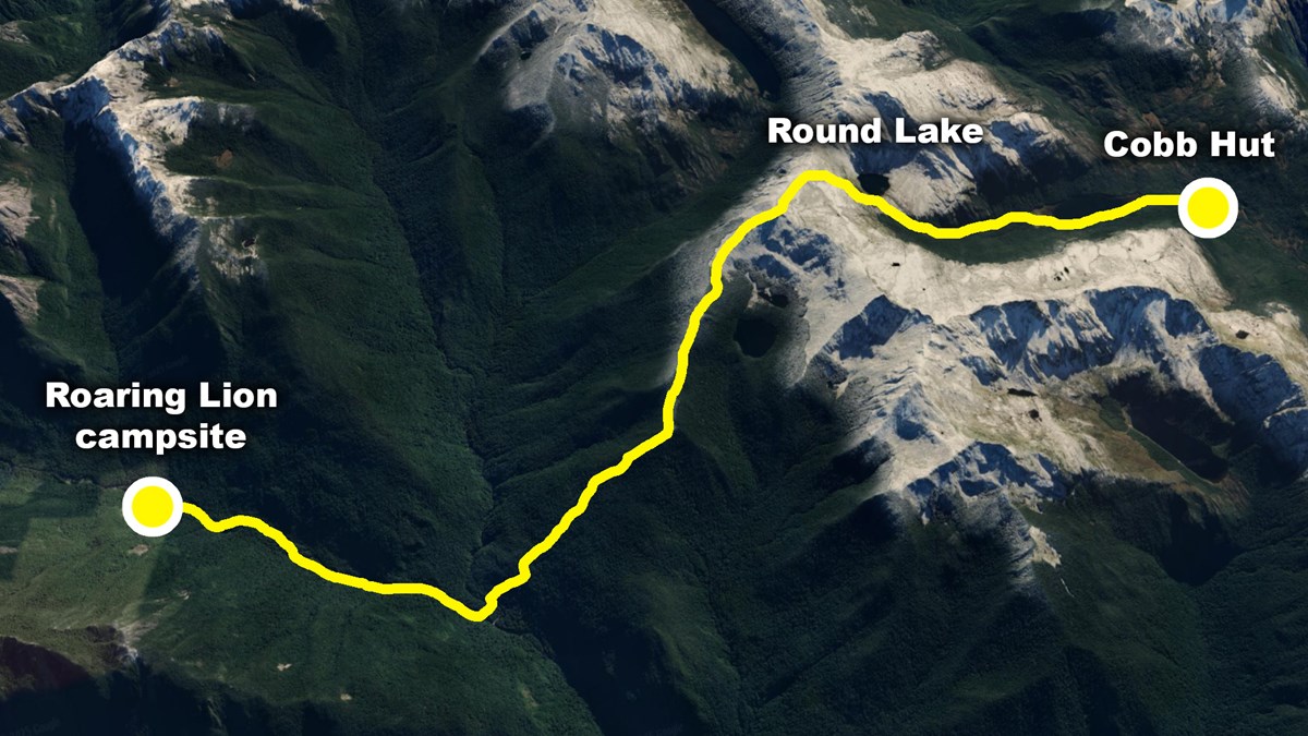
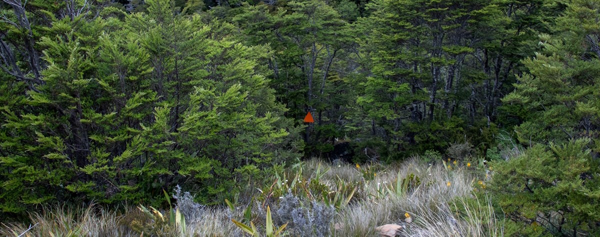
As the cloud claggs in again, we cross over the ridgeline to Round Lake, and meet our first ever DOC marker in 5 days!
I already miss the off-track experience, and walking on the gravel trail feels like walking on a paved road in central Auckland. I yearn to be back in the Roaring Lion, though the aches and pains in my body remind me that spending even more time off-track might not be the best idea.
Not long after we make it to Cobb Hut, we run into the first building (and first other human beings) we’ve seen in 5 days. We tell them all about our adventures over the previous week.
Day 7: Homeward bound
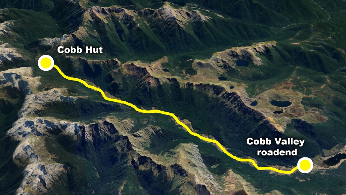
Leaving Cobb Hut, our last day is laughably basic and just involves a highway of a track back to the carpark, passing lots of families and day walkers along the way. The 5-ish hour track seems to go by in about 10 minutes. Once back at the carpark we are reunited with the car just in time before the rain arrives.
During our drive back we get an internet connection and hear about all the news of the world (basically nothing really, aside from the government doing the usual bad things). We check up on something we saw on the drive in, and confirmed that the “Asbestos cottage track” is in fact “closed for asbestos danger”.
As we drive back towards Nelson, a massive thunderstorm pops off, and we wonder what it would have been like to experience this in our little tents up on those alpine basins and river flats of the last week. Tommy is also reunited with his phone (which he left all the way back at Fenella Tarn on day 2, and was found by a previous VUWTC member who got in contact with us!).
After grabbing some well earned pizzas for dinner, we get a proper night's sleep as more thunder rolls through Nelson. Being under a roof with the raging storm outside makes me feel a world away from the whole experience of the last week. I miss it already.
So after reading this monster of a trip report, I hope you might just feel inspired to go beyond the arbitrary boundaries of tracks and huts, and explore the massive world of off-track bush that New Zealand offers you. The world of true bushcraft begins when you leave the DOC track markers behind!
And thank you so much to VUWTC for making this trip possible!
Plus a massive thank you to everyone who's advice and first-hand knowledge helped in the planning of this trip, like my parents, extended family, several pros from the Nelson tramping scene, and many others online!
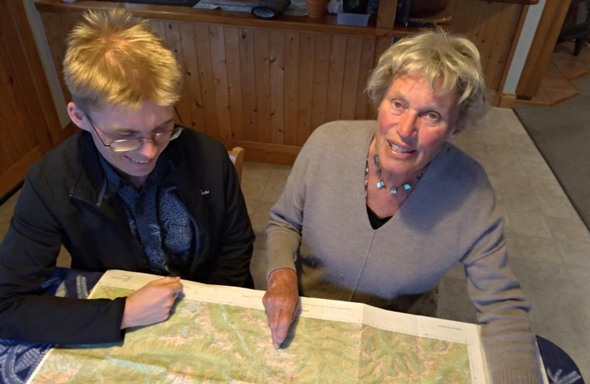
My auntie Marion sharing first-hand knowledge of the Cobb valley and Roaring Lion catchment